Postgraduate Researcher Tom Wilkes has been working with the Urban Flows Observatory on the development of novel remote sensing equipment.
Following a background in Earth Sciences, Tom embarked on a PhD in Volcanology at the University of Sheffield in 2015. During this time he has designed and built a low-cost UV camera, spectrometer and thermal imaging camera, to aid in volcano monitoring and research. It is this interest in remote sensing technology which has led him to work on developing a 3-Dimensional thermal imaging system as part of his research with the Urban Flows Observatory.
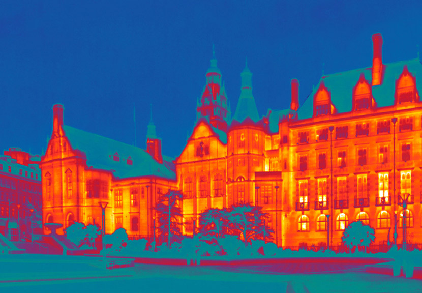
Heat Sensing in the City
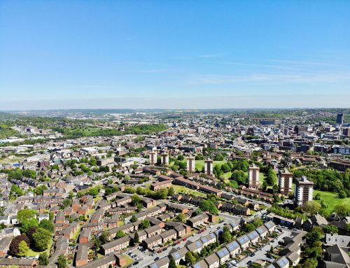
One of the principal aims of the Urban Flows Observatory is to source information about the temperature of buildings around the city. The purpose of this data is to assess their thermal performance, shed light on their material characteristics, and later advise on improvements to building stock in the city, by, for example, retrofitting insulation or treating damp problems.
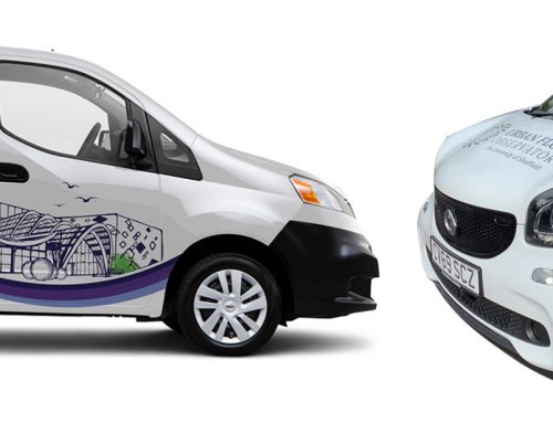
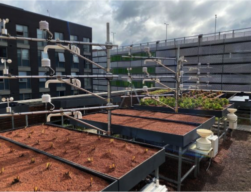
In order to measure the factors affecting the quality of the environment within Sheffield, the Urban Flows Observatory has developed The MOBIle Urban Sensing vehicle, ‘MOBIUS’. This roaming unit is being fitted with a wide array of mobile sensing equipment.
Tom’s objective was to create a unit capable of retrieving 3-Dimensional thermal images and developing the software to process this data, within the parameters of being both low cost and portable (to be transported by MOBIUS).
Thermal Imaging and City Mapping
Thermal imaging is the practice of retrieving a 2-Dimensional image where each point in the image represents the temperature of the object in that region.
Tom‘s work has involved early-stage development of a novel system capable of producing 3-Dimensional thermal images. This measures both the temperature and distance from the camera of any point in an image. The functionality is particularly useful in mapping a city; if the location of an object is known (an x-y-z coordinate), a 3D reconstruction can be built and navigated around. The capabilities are similar to those of Google Earth, except instead of returning the object’s colour, the thermal properties can be viewed.
When looking to investigate the thermal efficiency of buildings, considering the city of Sheffield as a whole, this new ability could be extremely powerful.
The Thermal Imaging Unit and Software
The imaging unit is constructed from a number of commercially available, but separate, instruments: a thermal line scanner, a Light Detection And Ranging (LiDAR) unit, and a standard visible imaging camera.
The thermal line scanner retrieves the temperature of a point, and by scanning its viewing direction in a line, it can retrieve temperature data points extremely rapidly. Similarly, the LiDAR unit scans in a single plane and therefore by mapping the LiDAR data (which provides the distance to an object) to the thermal line scanner data, we can retrieve information on both an object’s dimensions and surface temperature. In practice, software processing accounts for any differences in data acquisition rates and position offset between the two instruments.
These instruments also need motion to build their image accurately; this is where MOBIUS acts as the facilitator. Complex issues such as road imperfections and speed variations can also be corrected for in software processing, with the help of a further integrated instrument providing speed and inclination data. This work is an ongoing area of research.
Additionally, a visible imaging camera provides a humanly comprehensible view of the scene and a different way of visualising the results.
Much of Tom’s project has focused on the development of software to control the instruments and process their data into something meaningful. This software is a series of programs which perform the required tasks: communicate with the instruments, retrieve data and save in a sensible format, process the data to produce a useful and informative reconstruction.
Thermal Imaging of Sheffield
Tom’s custom built low-cost sensing unit can be seen on the street of Sheffield as of Autumn 2018, when MOBIUS hits the streets gathering data to create a growing and evolving sense of the environment in Sheffield.